
Viennese founder shows how shadows are falling worldwide
Georg Molzer has ended up on the dark side of the Internet. Well, actually on the dark side. The former Head of Mobile Design at Jumio and CTO and co-founder of the controversial health startup Kiweno is leaving his new startup Shadow map completely new ways and wants to make 3D visualizations of shadow cases digitally accessible on an online map. To do this, he teamed up with Simon Mulser, a former colleague of Kiweno.
Molzer put two years into the new project, this week the product launch begins. In a big interview with Trending Topics, Molzer reveals what he hopes for from Shadowmap, how the technology works and who the potential customers are. During the conversation it quickly becomes apparent that there are very large application scenarios for what appears to be a gimmick.
Trending Topics: What problem does Shadowmap address? And what does the solution look like?
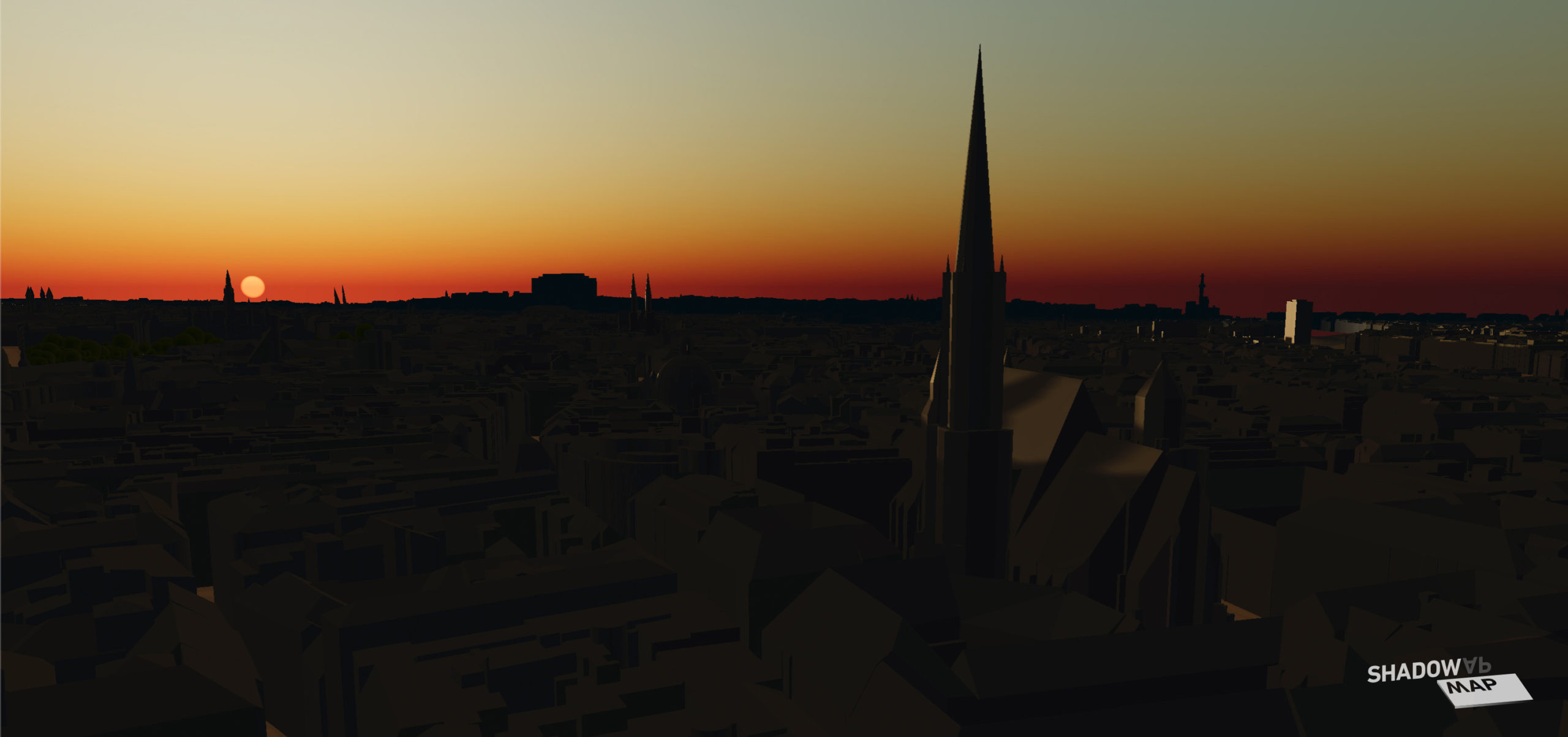
Georg Molzer: I had the idea for Shadowmap in the winter eight and a half years ago when I actually didn’t see any sun in Vienna Neubau for two weeks: Narrow streets, tall houses, flat sun. The perfect framework for a cloudy Viennese mood. The time was also very labor-intensive and I wanted to find a sunny spot in the area at least during the lunch break. To my surprise there was no tool, although 3D data should be available.
It quickly became clear that there are many use cases for such a “solar shadow map”: Creatives – i.e. photographers, cinematographers, drone operators and lighting technicians – have not yet been able to precisely and especially remotely in Include your planning. Existing AR tools require physical presence at the location; at the same time, buildings and terrain that cast shadows are ignored.
There is a similar problem when looking for an apartment. Currently, you have to rely on the fact that the sometimes overexposed photos on a real estate platform reflect the truth. If you look at the property in person, you will only see it at one point in the year, although the amount of sunlight that comes in can vary considerably depending on the season. The further you are from the equator, the more glaring this difference is. And on the seller’s side, there is no way to simply and objectively depict the lighting situation in a property.

And of course it goes on: Without the energy of the sun, nothing here would be as it is. Plants need them, people need them. In addition, last year photovoltaics developed into the cheapest method of generating electrical energy – much faster than predicted by experts. There are studies that state that people in Southeast Asian metropolises only get 8 to 10 percent of UV radiation due to increasingly tall buildings, which has an impact on the vitamin D level and thus health.
On the other hand, it is predicted that by 2050 room cooling will make up the highest energy demand in buildings. Not to mention climate change and the influence of the sun. In short, there are a myriad of use cases that would benefit from making solar access easy to plan and predict – and Shadowmap does just that.
How does the tool work in practice?
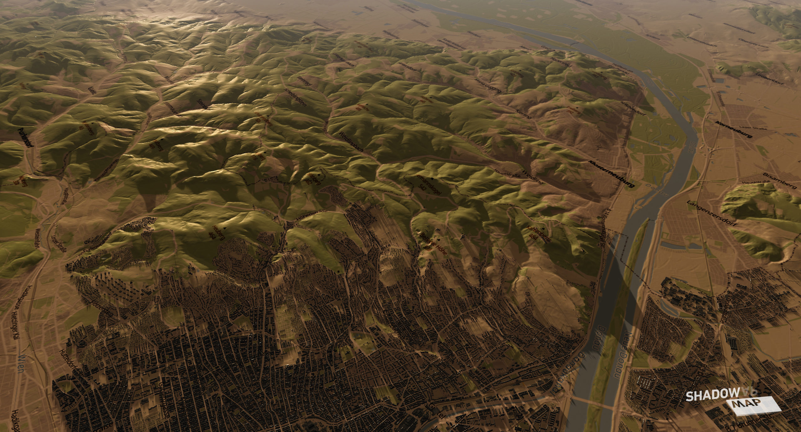
Shadowmap visualizes sunlight and shadows on the basis of a precise sun model in combination with global 3D buildings and terrain data. These are processed in an intelligent way to enable interactive 3D visualization that works on any device: whether on a smartphone or in a web browser on the desktop. Our app is available immediately, without tedious installation or data downloads. Optimal usability and performance have always been extremely important to us – which is quite a feat considering the massive amounts of data that are mostly processed here in real time.
Where do you get the data from? For which regions are they available?
We currently work almost exclusively with open data: Terrain (i.e. mountains, valleys, etc.) comes from a wide variety of global data sources, which also results in corresponding differences in quality. Austria should be emphasized here, for example, there is hardly any higher quality. In other places, such as the New York Cities coastline, we are struggling with data artifacts.
Our basemap and global 3D building coverage are fed from OpenStreetMap data. Behind OpenStreetMap are the pioneers of digital cartography – many other giants such as Mapbox build on it and the whole thing existed long before Google Maps and co.
With regard to 3D buildings, we started with the Open Data Initiative of the City of Vienna, which is making a highly detailed city model freely available. This 2 GB data set had to be compressed beforehand in order to be usable in practice. We’re still thrilled that we only need 48MB for the whole city in 3D. And: only what is needed is streamed. We will also soon be planting 200,000 virtual trees in Vienna – fed from the metadata of the city’s tree cadastre.
With the launch on May 25, we will go live with global buildings in addition to the global terrain coverage that has already been available. An important step for the project and for our vision to turn Shadowmap into a globally useful tool. In the medium term, we want to provide the best possible answer to any question about solar radiation.
Who are the customers? Who is likely to pay for the Pro version?
In this phase we focus fully on creatives and the real estate market or proptech. Creatives are primarily served via our SaaS, into which we will integrate further features in the future that will make their work processes easier. As early as April, when we were still in beta, a request came from Red Bull who needed help for a shoot in Turkey: It was important to know whether the incidence of light in a mountain region was better in April or September for their planning is. It was April. We also received initial inquiries from real estate developers and in June we will implement a first real estate pilot project. And what we’re particularly pleased about: A European solar car manufacturer approached us to integrate Shadowmap into the infotainment of its cars.
Shadowmap Pro – our SaaS – will go online on May 25th and we are also offering a launch offer at half the price of 99 instead of 199 for the first 100 registrations. The first reservations have already been made.

What will the Pro version contain? What are customers willing to pay for?
The Pro version allows complete 3D freedom of the camera. One can take a close look at the sun in the sky as well as vertical building surfaces. Furthermore, any date in the past and future can be selected. These features are limited in the open version. In addition, there is a high-quality rendering mode for the best possible quality – this also places higher demands on the hardware. But that’s just the beginning: There is a long list of other functions that will be gradually integrated and then of course made available to existing pro users.
In this regard, we are in constant contact with creative people and are also considering including them in the prioritization process. Among other things, there will be a 3D overlay with meta information about incidence of light, etc., simulation of lens focal lengths, first-person mode and probably also a moon visualization. Native apps are also in great demand and we want to deliver here asap.
In December we conducted a survey among creatives to find out how they work and what they need. It turned out, for example, that they invest at least one to five hours per month in lighting planning and the vast majority would like to be able to do this remotely. We are convinced that we not only offer you great time savings, but also the necessary level of predictability and precision to produce great and extraordinary content.
There is still no company – should one be founded? So that investors can also get on board?
This April, a sole proprietorship was registered to provide the legal basis for today’s launch on May 25th, simply because it had to be done quickly. But this will probably be followed by an OG or GmbH in the summer. We’d love to bootstrap, but we’re not averse to smart money. We would like to have a well-networked investor on board, especially with contacts in solar energy or the real estate market.


